Proposed Reservoir In TN Sparks Debate Over Wetland, Livelihoods
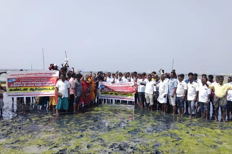
More than 200 fisherfolk protest against the Mamallan reservoir project at the wetland site, fearing adverse impacts on the coastal ecosystem that sustains their livelihoods (Image courtesy of Vettiver Collective)
- Tamil Nadu is converting a coastal wetland in Chennai into a reservoir. Called Mamallan reservoir, it will be the city’s proposed sixth drinking water source.
- Naturalists and conservationists say the project’s environmental assessment raises questions about its claims on flood mitigation, groundwater recharge and ecological impacts.
- The site is a critical habitat for migratory birds, which will be impacted if the landscape changes.
- Fishing communities who depend on the wetland also worry about the project’s impact on their livelihoods.
Standing on the muddy bund of the Great Salt Lake near Chennai, Narayanan R. watched a flock of flamingoes forage through the shallow waters. For him, the wetland is more than a landscape—it is a lifelong companion. “I stood here as a 10-year-old when my father first taught me how to fish,” he recalled. “The flamingoes may not come next season. These pools will dry soon.”
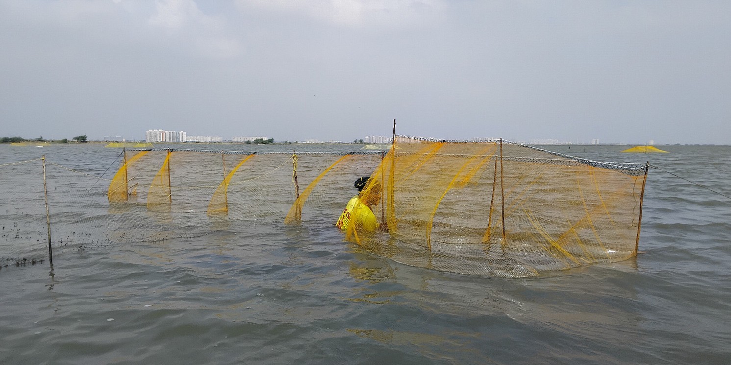
A short distance away, Gowriamma searched through the muddy shallows for shrimp, a livelihood her family has depended on for generations. “Everything depends on these small pools,” she said. “We know this water through the mud and the thorns.”
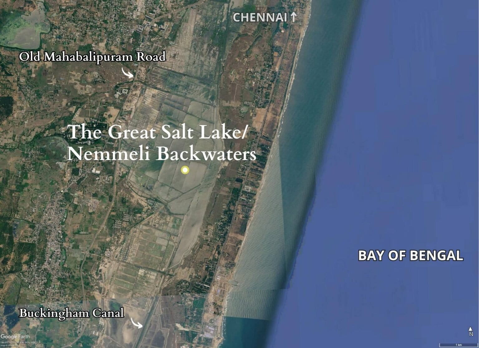
The Great Salt Lake, also known as the Kovalam-Nemmeli backwaters, stretches across nearly 5,000 acres between Nemmeli and Kovalam along Chennai’s East Coast Road. The Tamil Nadu government plans to convert this coastal wetland into the city’s sixth drinking water source through the proposed Mamallan Reservoir.
The project is intended to address Chennai’s growing water demand. According to the Environmental Impact Assessment (EIA), the city currently supplies between 700 and 800 million litres per day (MLD), while demand has already crossed 1,100 MLD and is projected to exceed 2,500 MLD by 2035. The proposed reservoir is expected to provide 170 MLD, with a storage capacity of 1.65 thousand million cubic feet (TMC) in a single filling and an annual storage of 2.25 TMC.
For local fishing communities, however, the project represents the possible loss of an ecosystem that sustains both livelihoods and biodiversity.
“Who are we to change the contours drawn by nature?” Narayanan asked.
Although the wetland falls under the Tamil Nadu Water Resources Department (WRD), it has long functioned as a productive fishing ground, a seasonal habitat for wildlife and an important flood buffer for surrounding areas.
The foundation stone for the project was laid on January 19, 2026. Since then, fishing communities have staged repeated protests demanding that the project be reconsidered. Following the state elections in May, villagers hoped the new government would review the proposal. On June 16, fishers from nearby villages gathered at the Kovalam fish market, urging authorities to abandon the project. Construction, however, continues.
Scientists describe the Great Salt Lake as an ecotone—a transition zone where freshwater and seawater interact to create a unique coastal ecosystem.
“Twice a day, seawater from the Bay of Bengal enters through the Muttukadu and Kokilamedu inlets and spreads across the wetland,” Narayanan explained. “Twice a day, it recedes.”
The Buckingham Canal carries excess freshwater towards the sea, while mangroves and salt marshes help buffer the coastline against storm surges.
The wetland has already experienced considerable environmental pressure. A 100 MLD desalination plant commissioned in 2013 has been linked by marine conservationists to coastal erosion and saltwater intrusion. A second desalination plant became operational in 2024, while another remains under construction nearby.
Concern over the reservoir project has united ecologists, hydrologists and bird experts. In February 2026, 22 scientists wrote to the Tamil Nadu government warning that converting the wetland into a freshwater reservoir could irreversibly damage the ecosystem.
One major criticism concerns the environmental assessment itself. The EIA was conducted between April and June 2025, missing the northeast monsoon and the migratory bird season.
“The EIA has to be a year-long monitoring exercise and should reference data over at least 50 years to account for climatic variability,” said Elango Lakshmanan, faculty member at IIT Madras and a member of several government monitoring committees.
Naturalist Yuvan Aves, who has surveyed birds at the site since 2017, questioned the ecological rationale behind the proposal.
“The biggest conflict is between what’s written in a document and the ecological reality,” he said. “There is no precedent of constructing a reservoir within a coastal wetland.”
Questions over flood control, biodiversity and livelihoods
The project also faces scrutiny over its claims regarding flood mitigation and groundwater recharge.
According to the EIA, flooding in villages west of Old Mahabalipuram Road results from three major causes: raised salt-pan bunds that obstruct drainage, inadequate outlets along the highway and the Kelambakkam-Kovalam Link Road blocking a natural floodplain.
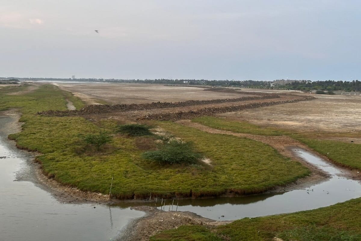
The reservoir proposes to address only the first issue by removing bunds and installing peripheral drains.
Environmental organisation Suzhal Arivom argues that the proposal fails to resolve the more significant causes of flooding.
The EIA itself acknowledges risks including bund breaches, overtopping, downstream flooding and spillway failure during extreme rainfall. However, critics say its suggested mitigation strategy—proper maintenance of outlet regulators—is inadequate.
“The documents don’t clearly explain the mitigation,” said Vijayaraj B., MLA for Thiruporur constituency. “We have asked the Water Resources Department for a detailed plan with clear solutions. Once I receive it, I will personally explain it to the affected communities.”
Questions have also been raised over groundwater recharge.
The EIA notes that the reservoir site consists largely of low-permeability clay and clayey loam, soils that allow little downward percolation.
A 2022 IIT Madras study found seawater intrusion extending nearly 700 metres inland, largely because coastal sand dunes that once acted as natural recharge barriers have disappeared.
“If there is already so much risk of salinity intrusion, what’s the point of creating a freshwater reservoir here?” asked Deepak Venkatachalam, founder of Suzhal Arivom. “Water moves according to gradients. It remembers its ways.”
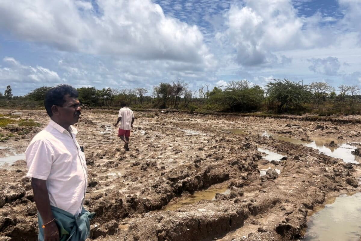
Conservationist Saravanan K. criticised another omission.
“For a project that permanently converts a coastal wetland, the EIA contains no meaningful environmental cost-benefit analysis,” he said. “This is not simply a procedural oversight but a fundamental failure.”
Fishing communities argue that their dependence on the wetland has been almost entirely overlooked.
Thousands of residents from Thiruvidanthai, Nemmeli, Pattipulam and neighbouring villages harvest shrimp, fish and crabs from shallow tidal pools that also function as nursery grounds for juvenile marine species.
The EIA mentions fishing communities only briefly, stating that fish and prawn populations may be affected until “natural hydrology is restored.”
It does not estimate how many livelihoods depend on the wetland.
“Destroying these tidal pools doesn’t affect only a few fishers,” Narayanan said. “It breaks the entire breeding cycle that sustains offshore fisheries.”
Vijayaraj said the WRD is preparing a compensation package for affected fishers and plans to issue identification cards allowing continued access during parts of the year.
For many families, however, displacement is not new.
“We were moved here after the Kalpakkam nuclear plant displaced us years ago,” Narayanan said. “It is the same story all over again.”
The wetland is equally significant for wildlife.
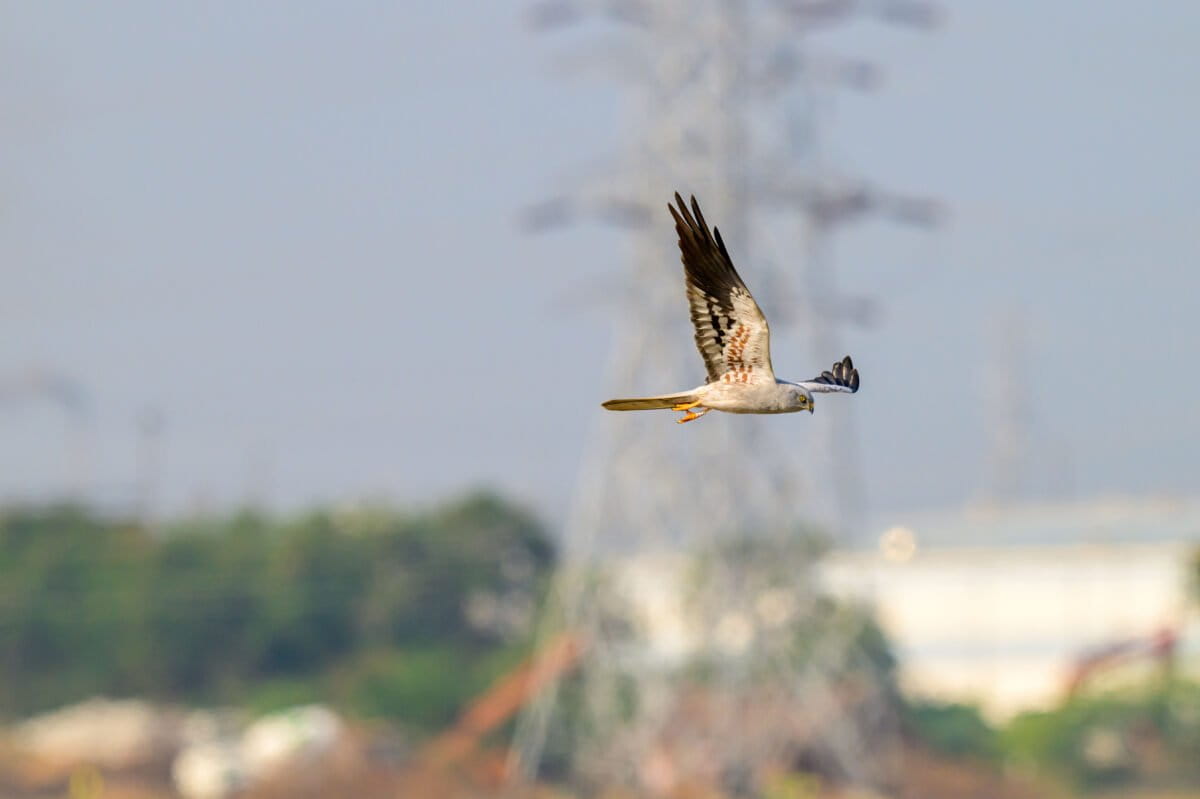
Every winter, thousands of migratory birds travelling along the Central Asian Flyway arrive here. The Wildlife Institute of India has identified the area as one of only 107 Important Marine and Coastal Biodiversity Areas nationally.
The EIA documented 102 bird species, acknowledging potential impacts on wading birds.
“Shallow brackish water is extremely productive,” said Yuvan Aves. “Depth and salinity matter enormously. Many birds cannot feed if the water becomes too deep.”
He explained that the proposed reservoir would increase water depth to around three metres during the monsoon.
“The mudflats will disappear,” he said. “If the salinity changes, the birds won’t come.”
Although the EIA proposes creating artificial islands and converting abandoned salt pans into bird habitat, critics argue such measures cannot replace natural wetlands.
“Most wetland birds return to exactly the same feeding grounds every year,” Yuvan said. “Even slight changes in water depth can make those sites unusable. Forced displacement can lead to starvation and conflict with other bird populations.”
Another criticism centres on the lack of alternative options.
The EIA simply states: “No other alternative site examined for storage of water.”
Deepak Venkatachalam believes authorities should first restore existing tanks, lakes and canals before sacrificing a functioning coastal ecosystem.
Water expert S. Janakarajan, president of the South Asia Consortium for Interdisciplinary Water Resources Studies, noted that neighbouring districts contain more than 3,600 interconnected water bodies.
“The first priority should be restoring stormwater drains and desilting existing tanks,” he said. “That would significantly increase storage without disturbing the coastal ecosystem. There is no way we can artificially create a water body that matches the hydrological and ecological integrity of a naturally occurring wetland.”
Janakarajan, however, offered a more nuanced view, suggesting that designating the area as a reservoir might inadvertently protect it from future commercial development.
That, he argued, reflects a larger policy gap.
India’s land classification system recognises forests, private land and government land, but offers no dedicated legal category for wetlands or traditional fishing grounds.
Meanwhile, the EIA itself classifies nearly 14.68 square kilometres of the project area as coastal wetland, even while proposing to transform it into a freshwater reservoir.
Conservationists have instead urged the government to notify the site as the Mamallan Lagoon, granting it formal ecological protection.
For now, however, work on the reservoir continues, while debates over water security, flood management, biodiversity conservation and the future of one of Chennai’s last major coastal wetlands remain unresolved.