To Protect Our Oceans, We Must Map Them
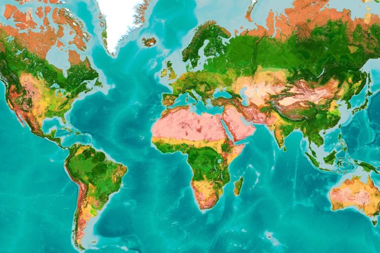
A global map that visualizes marine elevations (Image courtesy of Esri
How had we missed this until now? An undersea mountain as tall as three Eiffel Towers. DDT contamination spread across an area of the seabed as large as San Francisco. Tens of thousands of undersea volcanoes. All hidden beneath the surface.
For decades, my impassioned ocean science colleagues and I have spoken out about the need to “save our ocean.” But to save it, we first have to understand it.
About 80% of our ocean remains “unmapped, unobserved, and unexplored,” according to the U.S. National Oceanic and Atmospheric Administration. And that’s despite scientists, including myself, who have spent their lives studying and even diving to its unexplored depths.
Now, we have the right technology to understand — and save — our oceans.
Un-crewed, solar-powered marine drones explore with a wide range of sensors. High-resolution satellites and aircraft collect imagery. Remote operating vehicles can go deeper and further while recording data from the environment below. When paired with modern digital mapping, this new information reveals critical insights. There are even plans to build the Proteus research facility, akin to the space station, underwater off a Caribbean coast where researchers will live and work. The timing couldn’t be better as there is growing global urgency to do more to protect our ocean.
All the excess heat our human activity is creating? The ocean absorbs much of it.
The oxygen we need? The ocean creates half of it, regardless of where on land we live.
After nearly 20 years of negotiations, we finally have a High Seas Treaty, achieved this year at the United Nations. This legal framework, once fully ratified, will go a long way toward protecting international waters. It was the talk of the annual Our Ocean Conference in Panama where 600 of us representing 190 countries committed to taking action.
The United States promised to spend a total of $6 billion. That figure includes $11 million for establishing and managing marine protected areas such as the new Hudson Canyon National Marine Sanctuary off the coasts of New York and New Jersey, home to sperm whales, sea turtles, and corals.
Setting aside areas of the ocean to be preserved starts with choosing the right locations. These are the spots that will offer the best chance for a diversity of species, of fish and seagrasses to flourish. Finding those areas requires filling critical data gaps of understanding.
Esri, where I work to advance science through geography and technology, is expanding a mapping application originally designed for National Geographic’s Pristine Seas program. The web-based tool will help world leaders as they identify more waters that should be protected, such as the proposed Chumash Heritage and Mariana Trench National Marine sanctuaries.
As the ocean absorbs harmful emissions humans are sending into the atmosphere, it’s also getting hotter. The trajectories of that hot water are partly based on the topography of the ocean floor, stirring up hurricanes and storms. Considering we’ve barely mapped a quarter of that topography so far, imagine what we could know, what we could prepare for, if every inch was mapped.
That’s why it’s such a thrill when each new undersea mountain or volcano is discovered and earns a headline. We are learning so much more about this place that influences every one of our lives, whether we know it or not, or live near the shore, or inland.
So many of us have rightfully gazed up at the mysteries far above our heads, searching the solar system for more life and reasons for how we came to be, cheering the technological advances that go up, up, up. We need to also glance down and do more wondering at the water below.
New innovations are affording us a better view of those vast waters. Shifting our gaze does more than save the ocean. It saves us.
(Published under Creative Commons from Mongabay. Read the original article here)