Land Acquired To Buttress Elephant Corridors Hits Farmers’ Lives
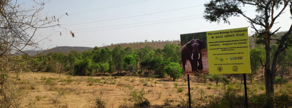
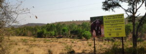
A board erected on land purchased to strengthen an elephant corridor adjoining the BRT and Sathyamangalam Tiger Reserve (Image by Ananda Siddhartha)
- The acquisition of land for elephant corridors is an example of how conservation interventions are expanding beyond protected areas and into surrounding agrarian landscapes.
- Restrictions on land access and use are imposed on the communities living around the protected areas, but there is a lack of compensation for crops destroyed by wildlife.
- As calls grow to reserve more land for biodiversity protection, the pressure on farming livelihoods is likely to intensify.
Acquiring agricultural land has been one of the strategies to strengthen elephant corridors in India, framed as a way to enable elephant movement between protected areas and reduce human-elephant conflict, among other reasons. Yet, this strategy approach plays out in complex and fragile rural landscapes with complicated tenurial arrangements, an aspect that has received little attention.
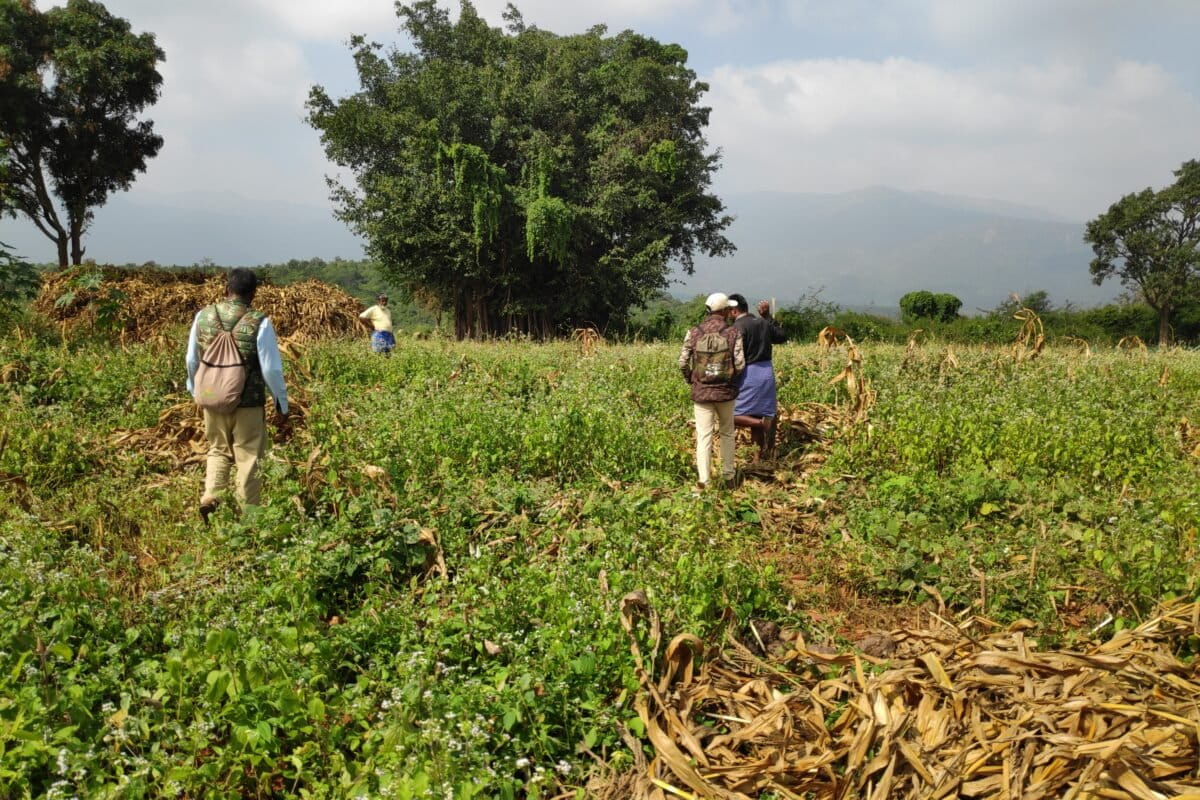
“First, they said that the forest was for the tiger. Now, they are saying this land is for the elephant. There has been no change after they bought the land. Elephants are still destroying crops,” said a farmer whose neighbour’s land was acquired to strengthen an elephant corridor connecting the Biligiri Rangaswamy Temple (BRT) Wildlife Sanctuary and Tiger Reserve in Karnataka with the Sathyamangalam Tiger Reserve in Tamil Nadu.
A corridor links separated habitats, enabling animals to move between them, safely. A push for elephant corridors in India gathered momentum in 2005 with the publication of a report titled Right of Passage: Elephant Corridors of India, that identified 88 corridors across the country. The report was the outcome of a collaboration between conservation NGOs, researchers, state forest departments and Project Elephant, a national government initiative to protect the elephant. Since then, the list of corridors has steadily grown. An updated version in 2017 recorded 101 corridors, and further revisions are underway. In 2023, the Ministry of Environment, Forest and Climate Change’s Project Elephant Division had identified as many as 150 elephant corridors nationwide.
A study published last year found that farmers living near protected areas, and whose land is identified as part of an elephant corridor, face multiple pressures.
On the one hand are restrictions imposed by the forest department and the absence of compensation for crops destroyed by wildlife. On the other are mounting pressures within the agricultural landscape. Drawing on our fieldwork around BRT, this commentary identifies five overlapping factors and forces that together form what it terms the ‘conservation-agrarian squeeze’, enabling the acquisition of land for elephant corridors.
Restrictions on access to protected areas
Since BRT was notified as a wildlife sanctuary in 1974 and later upgraded to a tiger reserve in 2011, controls on access to forest resources for communities living along the boundaries have steadily tightened.
Everyday activities such as collecting wild greens, tubers, gooseberries, firewood, and grazing livestock have been heavily regulated or restricted altogether, affecting the lives of people who depended on these resources.
The push to replace firewood with LPG has further increased households’ dependence on markets and raised living costs.
In addition, restrictions on grazing have sharply reduced pasture for native cattle, since most of the surrounding land is under cultivation and purchasing fodder has become prohibitively expensive — a shift the forest department itself acknowledges has contributed to a steady decline in cattle numbers.
Land use restrictions driven by zonation
By designating land beyond BRT as a buffer zone of the tiger reserve and ecologically sensitive zones (ESZ), conservation now extends well past the protected area boundaries. These measures bring farms, revenue lands, and villages under new regulatory frameworks aimed at safeguarding wildlife and enabling animal movement.
In practice, this means conservation priorities are increasingly woven into everyday land use outside the protected area.
Around BRT, dozens of villages now fall within zones where activities such as tree felling, borewell digging, and some agricultural practices are restricted or ambiguously regulated. The ban on new borewells, in particular, pushes farmers towards rain-fed agriculture at a time of growing climate uncertainty. Eco-development zones further reinforce this approach, promoting reduced grazing, afforestation on private land, and a shift to LPG and renewable energy to limit forest dependence. Official plans recognise agriculture as the main livelihood in these zones and call for a balance between farming and conservation, often framed as “eco-agriculture” and coexistence.
They also seek local cooperation and expect communities to curb grazing, reduce firewood use, and assist in protection efforts.
Together, these overlapping conservation designations have steadily tightened controls on land use and livelihoods, prioritising regulation over shared benefits and reshaping how communities live and work around the reserve.
Uncertain land tenure and changes in legislation
A large number of farmers are trapped in an increasingly precarious situation. In Karnataka, land tenure remains uncertain for many marginalised communities. Around BRT, this affects Soligas and others from different communities who were settled on forest land by the state beginning in the late 1950s.
This land, known as saguvalli patta land, comes with conditional titles that leave many owners without formal land records. Without these documents, selling land is nearly impossible. Such land can only be inherited, must be used for agriculture, and cannot be sold outside the local panchayat.
The lack of formal records also prevents farmers from being able to access bank loans, compensation for wildlife-related crop losses, and permission to dig new borewells — restrictions compounded by ESZ rules. As a result, many are left with little option but to continue with rain-fed farming or seek permission from the forest department to dig borewells.
Prolonged delays and frequent rejections place effective control over farming decisions in the hands of forest officials. The fallout is severe. Farmers with saguvalli patta land are unable to sell their holdings and cannot clear debts, unlike farmers with secure land titles who are also able to benefit from recent amendments to the Karnataka Land Reforms Act.
Unable to access formal credit, farmers with conditional pattas turn to high-interest informal lenders, sinking deeper into debt. Trapped in recurring cycles of debt, many farmers are ultimately forced to abandon agriculture or leave the area altogether.
Compensation for crop losses is challenging
Flaws in the compensation process make it extremely challenging, or in some cases impossible, for farmers to claim or receive compensation from the forest department after damage to their crops by wildlife. Elephant-proof trenches and solar fences installed by the department are often poorly maintained, leaving farms vulnerable.
Although the Karnataka Forest Department is meant to compensate farmers for wildlife crop damage, in practice only elephant-related losses are covered, excluding wild pigs that cause far greater destruction. Claims are complex, slow, and sometimes require bribes, and farmers without secure land titles are ineligible. Even approved payments cover far less than actual losses, discouraging many from applying.
Changing cropping patterns and volatile markets
Cropping patterns in the area around BRT have witnessed dramatic changes over the last few decades. Farmers who once depended on rainfed crops like millets, pulses, and traditional maize varieties now mostly cultivate hybrid maize, largely destined for poultry and cattle feed.
In addition, borewells have made year-round cultivation possible and enabled the shift to cash crops such as ginger, which is often grown on leased land and for which a lot of fertiliser and pesticide are used. Farmers describe this as a gamble: high input costs, price crashes, disease outbreaks, and erratic rainfall often leave them deep in debt.
For many, daily wage labour is not a choice but a necessity to cover household and farming expenses, and to repay loans. Those trapped in a vicious cycle often have little option but to sell their land. Farmers with secure title deeds are able to sell it to real estate speculators. However, those with conditional deeds sell it to conservation actors as seen in this case. Younger generations are leaving farming for jobs in cities, the construction or garment sectors, or in the gig economy, resulting in an aging rural workforce.
Although farmers experience each of these challenges separately, they are interconnected and revolve around access, land tenure, and finance. Together, these factors create a conservation-agrarian squeeze which, through the convergence of conservation interventions and agrarian dynamics, reshapes livelihoods and support systems.
The acquisition of land for elephant corridors is an example of how conservation interventions are expanding beyond protected areas and into surrounding agrarian landscapes. As calls grow to reserve more land for biodiversity protection, the pressure on farming livelihoods is likely to intensify, producing more instances of this squeeze while sidelining concerns around livelihoods, food security, and food sovereignty.
(Published under Creative Commons from Mongabay India)